PROBLEM

Socio-economic data sets are available at varying levels of granularity but they cannot be easily visualized on a map or correlated with other data sets for deeper analysis. Moreover, population density is also not known for arbitrary regions.
APPROACH


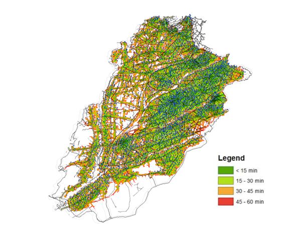
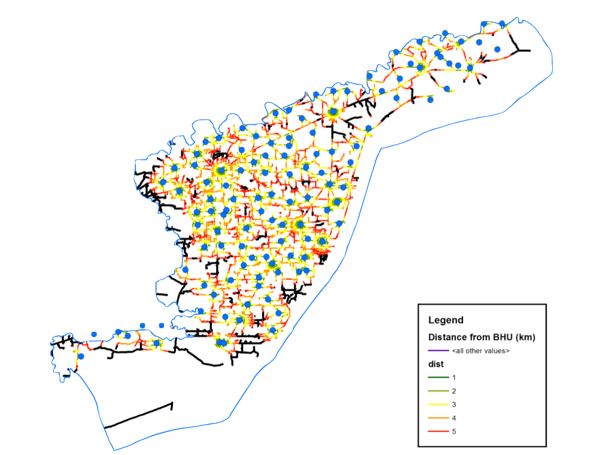
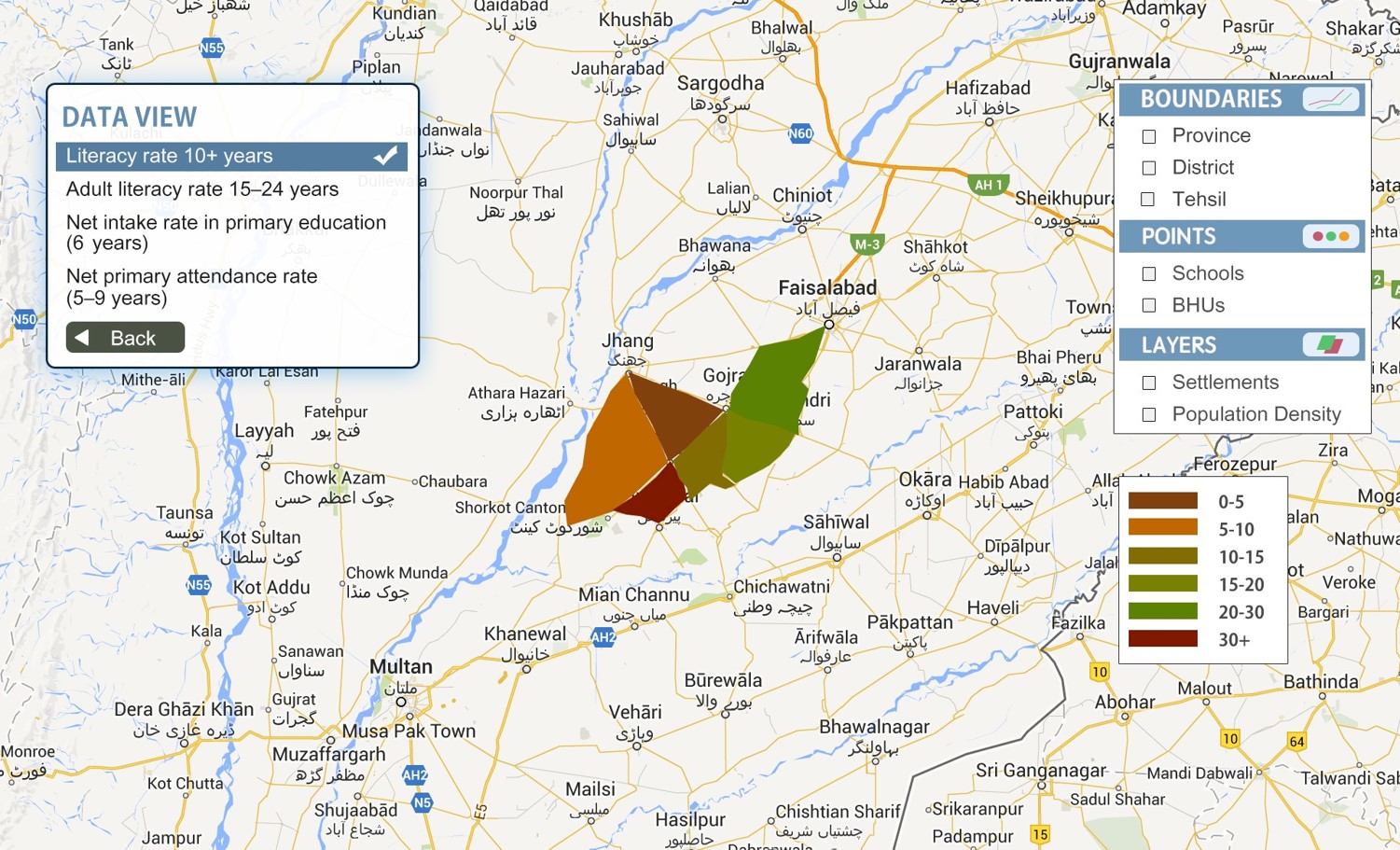
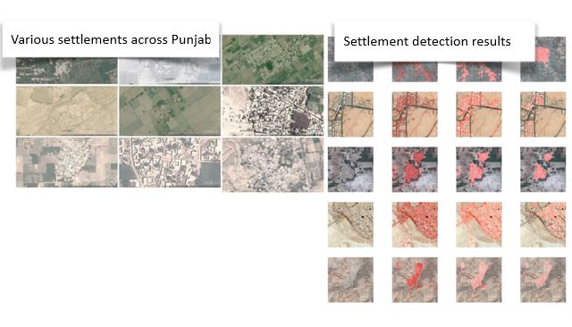
Developed an easy-to-use online tool to present survey data (MICS, LFS) and GIS data (boundaries and imagery). Created population density estimation layer using automatic (or manual) settlement detection and computed access to education and healthcare using location of facilities and road network. Composite indices for vulnerability, urbanization, etc. were also developed.
PROCESS
IN COLLABORATION WITH